Shopping for a waterfront home in Homosassa Springs can feel exciting and a little overwhelming. You want the right view, easy boating, and a property that holds value. The catch is that not all “waterfront” works the same here. Depth, tides, bridges, flood insurance, and permits can make or break your plans.
This guide breaks down your main waterfront options, how to match them to your boat and lifestyle, and the key checks to do before you write an offer. You will walk away knowing exactly what to ask, measure, and verify. Let’s dive in.
Homosassa waterfront basics
Homosassa Springs in Citrus County sits on a spring-fed river system that runs about eight miles to the Gulf. The Homosassa River and spring run are protected as an Outstanding Florida Water, which shapes what you can build along the shoreline and helps preserve the area’s clean water. You can learn more in the Southwest Florida Water Management District’s overview of the system.
Riverfront at a glance
- Direct access to the Homosassa or Halls River main channel.
- Often shorter runs to Homosassa Bay and the Gulf.
- Typically better for taller or larger boats when located downstream of low bridges.
- Expect higher purchase prices and insurance for prime locations.
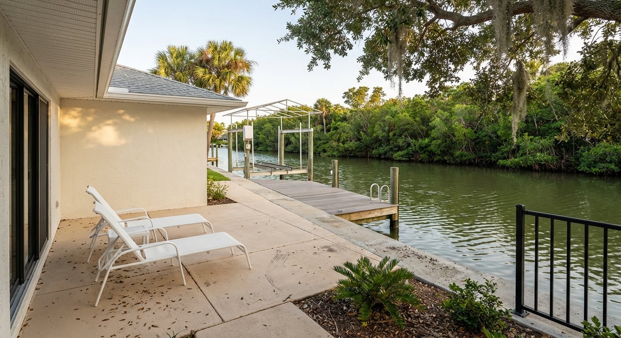
Canal-front at a glance
- Quieter, often more affordable waterfront with a sheltered dock.
- Narrower and shallower than the main river.
- Shoaling risk can limit access at low tide, especially for deeper-draft boats.
- Depth and maintenance history matter a lot.
Near-Gulf or marina access
- Live close to the water and keep your boat at a nearby marina or ramp.
- Lower private dock maintenance and fewer permitting headaches.
- A great match for offshore or taller boats that need depth and services.
- Confirm approach depths and slip availability with local marinas.
Boating depths and tides
The Homosassa River’s tidal swing is modest, but low-water depth still decides what you can run. NOAA’s local station at Tuckers Island shows Mean Higher-High Water around 1.92 feet, Mean High Water about 1.60 feet, Mean Low Water around 0.24 feet, and a mean range near 1.36 feet. In practice, you should care most about depths at Mean Low Water when judging a canal or dock. Check the NOAA datum table for Homosassa before you commit.
How to size your depth margin
A common rule used in marina design is to target channels at least 2 to 3 feet deeper than the deepest boat’s draft at low tide. That extra water gives you room to maneuver and accounts for shoaling. Always ask for depths stated “at Mean Low Water,” not just at high tide or “average.”
Local depth examples to consider
Nearby facilities often publish approach depths in the mid single digits of feet, which works well for bay boats and most center consoles. For instance, a Crystal River marina lists a minimum approach depth near 4.5 feet. Use these numbers as a starting point, then confirm conditions at your exact route and tide. Shoaling can change after storms or seasons, so verify with a recent sounder reading or marina survey.
Bridges and boat height
Boat height matters as much as draft. Some upstream areas have low fixed bridges that can be near six feet of vertical clearance in spots, which can block hard tops, T-tops, or towers at many tides. Listings may mention clearances, but they are not official. If a bridge could affect your route, measure your boat’s highest point, check the bridge at low tide, and confirm with the county DOT or the bridge owner.
Flood maps and insurance
Flood zones are only part of the insurance story today. Under FEMA’s Risk Rating 2.0, premiums consider your home’s elevation, distance to water, foundation type, and replacement cost, among other factors. Before you offer, pull a property-specific FEMA FIRMette and request preliminary quotes. If possible, ask for an elevation certificate to get the most accurate estimate.
Docks, seawalls, and permits
Work in or over Florida’s surface waters is regulated at multiple levels. Docks, seawalls, lifts, and any dredging generally require permits under state environmental rules in Chapter 373, and may also trigger review by the water management district and the U.S. Army Corps of Engineers. Vertical seawalls are limited to certain conditions, and dredging through seagrass or sensitive areas is often restricted. Because the Homosassa River is an Outstanding Florida Water, permitting can be stricter to protect water quality.
Manatees, seagrass, and speed zones
Homosassa is well known for manatees and seagrass beds. Expect seasonal speed zones, idle areas, and siting rules for boat facilities to reduce impacts on habitat. If you plan to build or expand a dock, check the Florida Fish and Wildlife Conservation Commission’s Citrus County boating guide and ask about potential permit conditions or mitigation needs.
Match the home to your boat
Choosing the right spot starts with your boating profile. Use these quick matches as a guide.
- Shallow-draft inshore angler or kayaker: Canal-front or sheltered riverfront can be ideal. Just verify low-tide depths and shoaling history.
- Offshore or taller dual-console: Favor riverfront downstream of any low bridges, or plan on a marina slip with confirmed approach depth and services.
- Low-maintenance second home: Consider living near the Gulf and keeping a slip at a local marina. You get water access without private dock upkeep.
Resale and marketability checkpoints
When you think ahead to resale, a few items can improve marketability and reduce surprises during inspection.
- A permitted dock and boat lift with documentation.
- An elevation certificate and clarity on how the home sits relative to Base Flood Elevation.
- Clear status of the canal or channel: public, private, or deeded access.
- HOA or deed restrictions that affect docks, lifts, or rentals.
- Known shoaling issues, dredging limits, or bridge constraints that affect access.
- Awareness of manatee zones or seasonal closures that change how and when you can boat.
Your waterfront due-diligence list
Before you write an offer, use this checklist to confirm the details that matter.
- Flood maps and quotes
- Pull a property FIRMette and request preliminary quotes under Risk Rating 2.0 from an insurer. Use FEMA’s Flood Map Service Center to start.
- Permits and elevation certs
- Ask for the home and dock permit files and any elevation certificates. Confirm status with the county building and floodplain office. Florida’s Chapter 373 outlines key permitting rules for work in surface waters.
- Measured depth at MLW
- Verify depth at the dock and along your approach route at Mean Low Water. A recent sounder reading or marina survey is best practice. The marina design guidance on depth margins can help you plan.
- Bridge clearance
- Measure your boat’s air draft and compare to any fixed bridges at low tide. Do not rely solely on listing notes. When in doubt, confirm with the local road authority.
- Habitat and speed zones
- Check for manatee sanctuaries, seagrass beds, and seasonal closures using the FWC Citrus County boating guide. Ask how these designations affect construction timing and boat use.
- Sewer vs septic
- Confirm whether the property is on sewer or septic. Systems near tidal waters can have different maintenance needs and may affect loans or insurance.
- HOA and rental rules
- If you plan to rent or add a lift, review HOA covenants and any local rules that could limit those plans.
- Marina back-up plan
- If you own a taller or deeper-draft boat, confirm slip options and approach depths with local marinas such as Riverhaven. Ask about services and any seasonal constraints.
Ready to explore Homosassa waterfront?
You deserve a home that fits your lifestyle on day one. If you want a second set of eyes on depth, bridges, flood and permits before you tour, let’s connect. With local knowledge across Citrus, Hernando, and Pasco, and hands-on construction insight, I can help you compare canal, river, and marina-access options with confidence. Reach out to Christine Hall to start a focused, low-stress search.
FAQs
What are the main waterfront types in Homosassa Springs?
- Riverfront, canal-front, and near-Gulf or marina-access homes. Riverfront usually gives faster Gulf runs, canals can be shallower but sheltered, and marina-based options reduce private dock upkeep.
How do tides affect boating in Homosassa?
- The tidal range is modest, but low-water depth controls access in canals and side channels. Always verify depths at Mean Low Water at the dock and along your approach route.
What bridge clearances should I watch for near Halls River?
- Some fixed bridges upstream can be near six feet of clearance, which can block hard tops or towers. Measure your boat’s height and confirm clearances at low tide before you buy.
How will flood insurance be priced on a waterfront home?
- Under FEMA’s Risk Rating 2.0, premiums depend on property specifics like elevation, distance to water, foundation, and replacement cost. Get quotes early and request an elevation certificate when possible.
Do I need permits to repair a dock or add a lift?
- Most work in or over surface waters requires permits under Florida’s Chapter 373 rules, and may also be reviewed by the water management district and the U.S. Army Corps. Start with existing permit records and consult the county.
Will manatee zones limit my boating or a new dock?
- Expect speed zones, seasonal idle areas, and siting rules to protect manatees and seagrass. These can affect how you operate and what you can build, especially in sensitive areas.